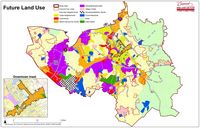
 Area Plans serve as a guide for making future decisions concerning land use, zoning, transportation improvements, open space, and other capital improvements. They also serve to identify opportunities for commercial revitalization, economic development, and mixed-use development.
Citizens in Concord play a key role in developing these types of plans. By participating in the planning process, citizens are able to channel neighborhood insights and other suggestions to City planners who can incorporate those ideas into area plans. Citizens and community committee members can participate in the planning process through public forums, surveys, and focus groups.
Area Plans can also lead to better urban design at the local level. Area plans can improve the design and management of public space (i.e. the 'public environment', 'public realm' or 'public domain'), and the way public places are experienced and used. Public space includes all spaces used freely on a day-to-day basis by the general public, such as streets, plazas, parks, and public infrastructure.
Area Plans:
► 2030 Land Use Plan
► Downtown Master Plan
► Concord Parkway (US Hwy 29) / Warren C. Coleman Blvd (US Hwy 601) Small Area Plan
► US Hwy 29/Roberta Church Rd Small Area Plan
► NC 73 Corridor Plan
► Center City Plan
► George W. Liles Pkwy Small Area Plan
► Weddington Road Corridor Plan
► The Boulevards of Concord
► Church Street Corridor Plan (IN PROGRESS)
2030 Land Use Plan
 The City of Concord has updated the Land Use Plan. The previous Land Use Plan, referred to as the 2015 Land Use Plan, was created in 2004 and updated in 2007. The newly updated Land Use Plan provides a vision and framework for land use and development through the year 2030.
The Planning & Zoning Commission held a public hearing and discussed the 2030 Land Use Plan at their regular February 20, 2018 meeting. The City Council adopted the plan on March 8, 2018.
Downtown Master Plan
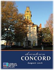 The City of Concord adopted its first Downtown Master Plan in 2002, with updates completed in 2008, 2016, and 2021. The planning process included public input sessions/meetings and the creation of steering committees to collect, review and share information. The plan focuses on four primary components: Visioning, Economic Analysis, Physical Improvements, and Parking Management.
The Downtown Master Plan will help to guide both the City's and Concord Downtown Development Corporation's efforts to foster appropriate commercial, industrial, and residential development for years to come. The boundaries of the Downtown Master Plan follow those of the Municipal Service District.
| Time Line |
|
| Study began |
February 2001 |
| Adopted by City Council |
2002 |
| Update adopted by City Council |
October 9, 2008 |
| Update adopted by City Council |
August 11, 2016 |
| Update adopted by City Council |
November 2021 |
Concord Parkway (US Hwy 29) / Warren C. Coleman Blvd (US Hwy 601) Small Area Plan
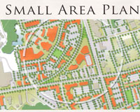 The Concord Parkway (U.S. Hwy 29) / Warren C. Coleman (U.S. Hwy 601) Small Area Plan was adopted by the City Council in May of 2007. This plan addresses the future market demands for retail, commercial, open space, and residential uses within the study area for the following twenty years. The vision of the plan establishes a unique character for the area through architectural, streetscape, and development/redevelopment opportunities which are based in market realities. The plan promotes a walkable, pedestrian-friendly environment. It recommends a diverse range of residential housing opportunities to accommodate a population with varied ages, races, and socioeconomic backgrounds. A variety of parks, plazas, recreational open space, and greenway network is recommended. The plan's flexibility is designed to accommodate economic changes and allows for incremental growth. A series of interconnected streets is provided to relieve traffic congestion, especially on the major thoroughfares, and to promote a safer more efficient driving environment. This plan has officially been made a part of the Concord Land Use Plan.
| Time Line |
|
| Contract awarded to consultant |
January 12, 2006 |
| Charette held |
November 21, 2006 |
| Public Meeting |
December 5, 2006 |
| Revision to plan |
April 2007 |
| Plan is made a part of the Concord Land Use Plan |
May 10, 2007 |
US Hwy 29/Roberta Church Rd Small Area Plan
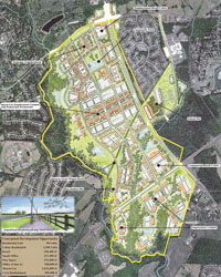 This small area plans serve as a guide for land use, zoning, transportation improvements, open space and other capital improvements for a 780 acre area of land close to the intersection of US Hwy 29 and Roberta Church Rd.
| Time Line |
|
| Contract awarded |
June 2004 |
| Workshops |
November 29 2004 - December 6, 2004 |
| Adopted by City Council |
August 11, 2005 |
| Made a part of the Concord Land Use Plan |
May 10, 2007 |
NC 73 Corridor Plan
 The NC 73 Transportation/Land Use Corridor Plan is a coordinated land use and multi-modal transportation plan for a 35 mile corridor. This plan is sponsored by three counties, five municipalities, various planning organizations, and the North Carolina Department of Transportation's Planning Branch. It is an innovative project, for implementation jointly by the local governments and NCDOT, integrating the local jurisdictions land use plans with strategic regional transportation needs.
In general, corridor plans are long range plans which help design a safe and efficient transportation system in the local community. They are developed in collaboration with local jurisdictions along the route, along with the vast number of users of the route. They identify improvements which may ultimately update, support, and refine the State's Highway System Plan. This process enables local agencies to consider the state system when building or revising local Comprehensive Plans. The plan also defines route continuity, access management, and multi-modal improvements. The plan also recommends specific improvements and helps to prioritize them.
| Time Line |
|
| City Council adopted memorandum of understanding |
June 2004 |
| Plan completed |
September 2004 |
Center City Plan
 The Center City Plan is a ten year plan that has been developed to establish a set of strategies for the future redevelopment and sustainability of the existing neighborhoods that surround the City’s downtown. City Council adopted the plan in December 2003. Center City is defined as the area bounded by Interstate I-85, US Highway 3 (Branchview Drive), US Highway 601 (Warren C. Coleman Blvd.), and US Highway 29 (Concord Parkway). In order to evaluate these neighborhoods more closely, Center City was broken down into fourteen (14) neighborhoods.
| Time Line |
|
| Study began |
February 2002 |
| Adopted by City Council |
December 11, 2003 |
GEORGE W. LILES PKWY SMALL AREA PLAN
 The 2005 small area plan for Concord Parkway/Roberta Church Road identified a land use pattern for 780 acres of largely undeveloped land. It recommended the alignment used to construct the George W. Liles Parkway extension, particularly the interchange with Concord Parkway S (US 29). This plan also reserved locations for key civic facilities; envisioned the Coddle Creek greenway; identified major activity centers; recommended urban, pedestrian-friendly development; and promoted new zoning districts and design standards to ensure attractive and sustainable future development.
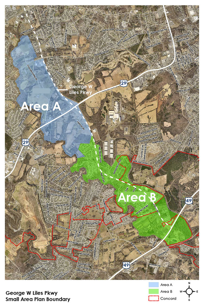
Much has changed in this area since 2005, but the 780 acres of land off George W. Liles Parkway remains mostly undeveloped. The planning staff is working on an update to this small area plan, with expanded boundaries stretching west to Coddle Creek and east to George W. Liles Parkway/Stough Road. The plan will focus on two distinctive areas:
Area A: Largely comprised of undeveloped land located in the Central Concord District per the 2030 Land Use Plan. Closely matches the 2005 Small Area Plan boundaries.
Area B: Mostly residential with some small-scale industrial and undeveloped land near Hwy 49.
Additional Information:
Weddington Road Corridor Plan
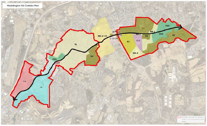 Weddington Road is a significant corridor for connectivity considerations for the City of Concord. The corridor covers a large surface area that is composed of a variety of new and existing neighborhoods, industrial facilities and parks. Weddington Road also crosses multiple greenways and key intersections where pedestrian improvements should be considered. The City of Concord would like to collect comments from the public to assist with future recommendation of the Weddington Road Corridor Plan.
Additional Information (pdf documents):
THE BOULEVARDS OF CONCORD CORRIDOR STUDY
 The Boulevards of Concord Corridor Study was created between 2023 and 2024 and represents the synthesis of extensive research; public business, and other stakeholder engagement and creative planning efforts undertaken by the City.
This plan includes two documents. The Inventory document provides extensive details of the existing conditions of the study area, including market dynamics, transportation infrastructure, and community and stakeholder engagement.
The Implementation document contains the results of the second phase of the planning process. It lays out recommendations across the Boulevards area to realize the vision stakeholders and the community established. This document includes suggested timelines for implementation and details about the value of each proposed strategy and how it ties into the community-based vision for the area.
For detailed information about Concord's Area Plans please contact us.